7 Applications for GIS Data
7 Applications for GIS Data
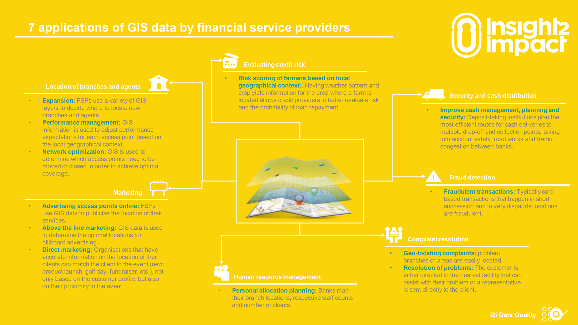
3 April, 2016 •The following is a brief from the insight2impact Data Quality team on their work with financial service providers (FSPs) on pioneering innovations in the application of GIS. It aims to provide a brief snapshot into the possibilities that financial access mapping can unlock. This document forms part of a forthcoming series of publications that will provide improved clarity on the application of GIS data in financial services delivery and the formation of policies.
Download the note
Size 529kb
insight2impact (i2ifacility) was funded by Bill and Melinda Gates Foundation in partnership with Mastercard Foundation. The programme was established and driven by Cenfri and Finmark Trust.
Comments on '7 Applications for GIS Data'
Similar Articles
How data fellows are contributing to reshaping Rwanda’s public institutions
Rwanda’s public sector has, over time, built substantial digital systems across ministries and agencies. These systems generate large volumes of ...
A practical decision framework for AI deployment in emerging economies
Introduction
Harnessing the transformative potential of AI for positive outcomes req...
Turning data into decisions: Lessons on dashboard development
At WASAC, Rwanda’s ...
How data-driven decisions fueled Ishyo Foods’ growth
Sharon Akanyana’s use of data has lifted ...
Thanks for sharing. I read many of your blog posts, cool, your blog is very good. https://accounts.binance.com/it/register?ref=P9L9FQKY